We went on a historical trip this past weekend. We traveled on the Wanganui River. It is one of NZ's 'Great Walks' even though it is a river trip. It starts on Mt. Tongariro and winds it's way along for 329km until it spills into the Tasman sea. It is New Zealand's longest navigable river.
It was used first by the Maori then by Pakeha (non-maori) to haul goods and people from the interior to the sea and back again. At the lower end of the river near the city of Wanganui there is a riverboat still chugging daily.
There are also rowing teams, water skiers and jet boats.
We had a jet boat meet us (two U of M med students and Cary and I) in Pipiriki to take us up river to the head of the trail to The Bridge to Nowhere. This was a 30km trip and I lost count on how many rapids the jet boat climbed with ease. A few times our driver, Joe, would stop and point out hazards for the canoeists on board (us).
Joe
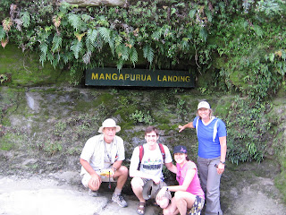
Everyone piled out and the other passengers went off on their hike and we got sorted out packing our barrels and loading up the canoes.
We then set out to the Bridge to Nowhere too. It sounds like a sad monument because it represents a sad part of NZ history. When the WW1 servicemen returned to NZ, the government of the day wanted to thank the soldiers by granting them land they could clear, farm, and live on. This land was almost in the middle of the island, it was very steep and thick with natural bush. A bridge was built in the middle of this bush across the Mangapurua River that fed into the Wanganui River.
The clearing proved impossible for the soldiers and after a few years of trying they left the land as is and really in the end said to the government, 'thanks but not no thanks'. They were not really compensated for their service in the war.
So in the end there sits a bridge in the middle of bush that comes from nowhere and leads to nowhere.
After this 1.5 hr hike we returned to the canoes and headed down river on our adventure. It is a beautiful river and there is a strong current that pushes the canoe along. The cliffs on each side are so high one has to crane their neck in order to see the top edge. Every now and then we would hear a tropical bird sing it's song or a bird of prey would majestically swoop along the cliff walls.
We landed at our campsite after 2 hours of paddling. Across the river was a Maori marae. It is their meeting place and if we wanted to camp there we would need to give them a koha (gift) and they would welcome us in. Across from the marae was Joe's Lodge which had accommodations and a bar.
We chose to stay where we landed and set up camp.
view across the river
We left the next day with 4 hours of paddling ahead of us. We were having wonderful temperatures, light winds, and sunny skies.
There were some caves to explore. There were deep, ice cold pools, gushing water- falls and the cave walls were thick with ferns and moss.
Cary went for a naked swim in a cave pool and after 30 sec became completely numb. When he was climbing out I saw a huge eel slime its' way under a rock. That was cool!
The rapids were thrilling and took a bit of negotiating to maneuver safely. We were quite winded and sunned when we returned to Pipiriki. It was very satisfying to complete such a historic trip.
Thanks for reading!


No comments:
Post a Comment